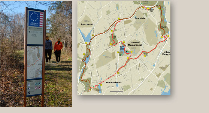
Clear signing and maps help package the experience of using public trails. The Colonial Greenway was assembled from four disparate trails – some dating back to the colonial era – in five communities to create a 15-mile loop trail for hiking and jogging. Meeker & Associates designed a double-sided map kiosk for each primary decision point with a section map, destination and distance information, and trail regulations. This wayfinding program made a very complex network of paths easy to use and understand. The map was developed in cooperation with the communities and the Westchester County Planning Department.


