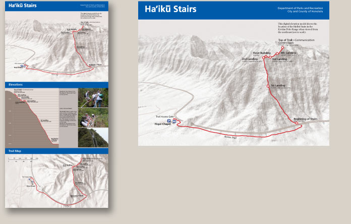
As part of a safety sign program, this three-map display shows the Haiku Trail on the west side of Oahu in plan, elevation, and digital terrain mapping developed with cartographer Everett Wingert.


As part of a safety sign program, this three-map display shows the Haiku Trail on the west side of Oahu in plan, elevation, and digital terrain mapping developed with cartographer Everett Wingert.